Hope Valley Train Station Walks

The train line that links Sheffield with Manchester was completed in 1894 and is still going strong 125 years later. Part of its route runs through the beautiful Hope Valley in the Peak District National Park, offering not just stunning views from the train windows but also ease of access to a host of pretty peak villages and breath-taking scenery.
It makes for a fantastic day out from Sheffield, especially when you don’t have a car or want to leave it behind in the city. If you need some ideas for where to visit along the Hope Valley Line, our friends at Let’s Go Peak District have compiled together a collection of five inspiring walks that start and finish at the train station in each village.
There are gentle ambles that are 4-5 miles long, to more challenging hikes of 7-8 miles. Best of all, they’re hand-picked to make the most of each location and to take you to the very best spots in the Peak District via the most scenic routes. From shady woodlands to heather-strewn moors, rocky edges to rolling pastures, this series of train station walks has it all...
The route links in each walk will take you to a page with detailed route information, map, GPX, preview video of the route and photographs.
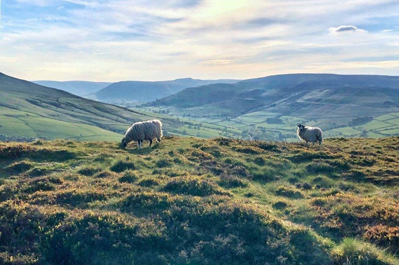
All photography thanks to Phil and Suzanne from Let's Go Peak District.
Grindleford (Moderate, 4.5 miles)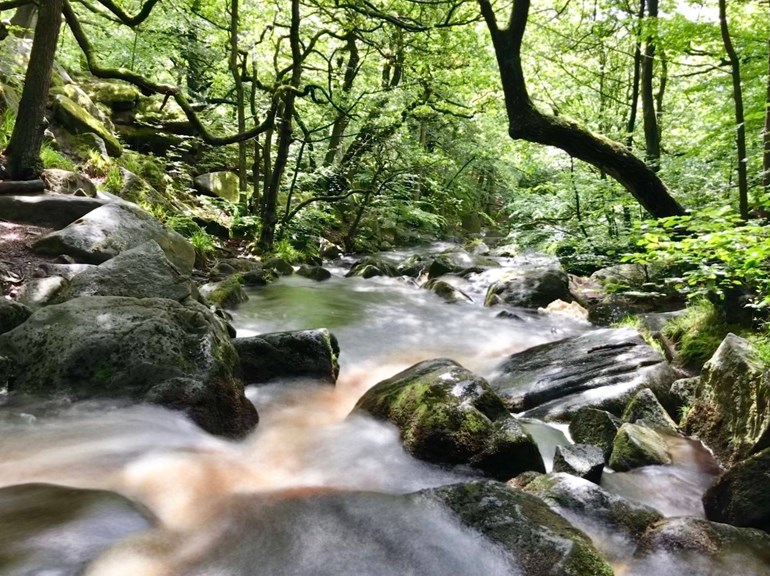
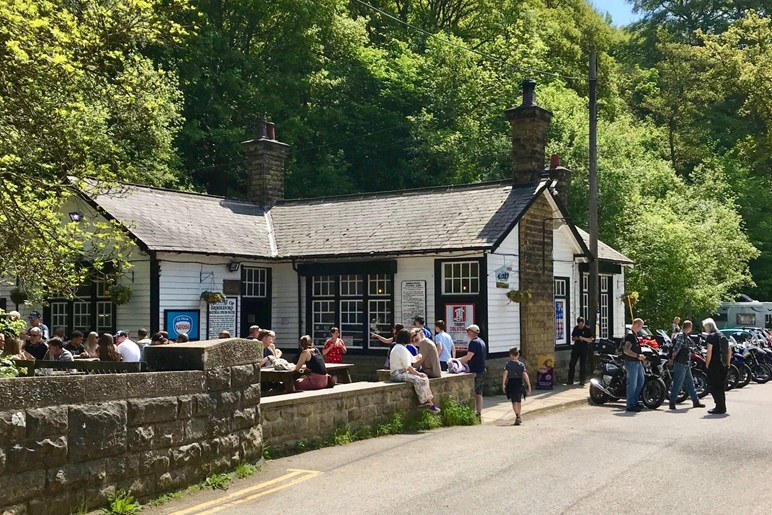
This beautiful walk from Grindleford Train Station is a real treat, taking you through stunning woodland and onto wild open moorland for breathtaking views – and all in less than 5 miles. The walk starts in Padley Gorge, an ancient mixed woodland, and traces the course of Burbage Brook as it tumbles over rocks and beneath pretty footbridges. From there, the route heads out over Hathersage Moor, around Millstone Edge and on to Surprise View, offering quite possibly the best views in the whole of the Hope Valley, before returning to the start point. Gindleford route details...
Hathersage (Moderate, 6 miles)
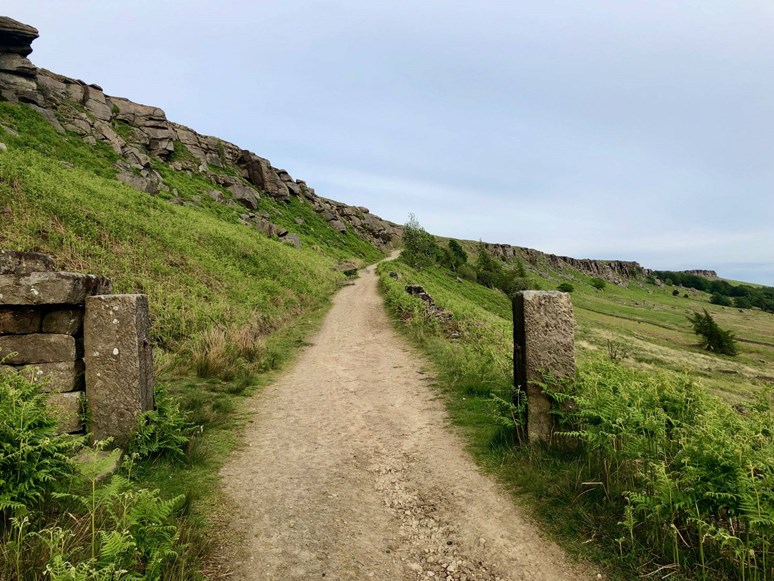
This fabulous walk from Hathersage train station provides a stunning glimpse of the very best of this part of the Peak District. You walk through the pretty village of Hathersage and out on footpaths up to the mighty gritstone heights of Stanage Edge (which straddles the Yorkshire-Derbyshire border). The views along the Hope Valley from the top are truly awe-inspiring. Then descend via Carhead Rocks and back into village, along very pretty country lanes, to return to the start point. Hathersage route details...
Bamford (Easy, 4 miles)
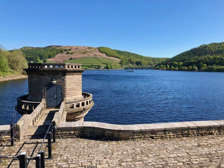
This lovely walk from Bamford train station takes in fabulous views around the pretty village of Bamford. The route heads past Bamford Mill and then follows the beautiful Thornhill Trail to the dam across Ladybower Reservoir. From there the route runs through pretty countryside with stunning views and along quiet village lanes back to the start point. Bamford route details...
Hope (Moderate, 6 miles)
This lovely circular walk from Hope train station is an absolute stunner! You leave the village behind very quickly and progress up over hill trails and footpaths on to Hope Brink. This affords you the most magnificent views of the Hope Valley, the Edale Valley and even into the Derwent Valley in places. The heights of Lose Hill and Kinder Scout tower above you, and you walk as far as Hope Cross, a medieval packhorse road marker, before returning to your start point via an old Roman road. Hope route details...
Edale (Challenging, 7.5 miles)

There’s no question that this walk from Edale train station is challenging in places, but it shows off some of the most spectacular views in the Peak District and definitely repays the effort. The route follows the Pennine Way out of the pretty village of Edale, with stunning views all across the Edale Valley to Mam Tor, and then follow farm trails to the lovely hamlet of Upper Booth. From Upper Booth you climb up on to Rushup Edge and along the ridge to the summit of Mam Tor, all the time with the most amazing views to both sides of you, of the Hope Valley in one direction and back across the Edale Valley in the other. From Mam Tor you walk along the iconic Great Ridge to Hollins Cross, and then down on hill trails and country lanes back to your starting point in Edale. Edale route details...
All photography thanks to Phil and Suzanne from Let's Go Peak District.