The Outdoor City Run Routes
Explore Sheffield by seeking out The Outdoor City Run Routes, with over 30 run routes signposted and mapped across 15 locations in parks and woodland across the city.
Take in panoramic views of the city, explore industrial waterways which have been reclaimed by nature, discover the largest ancient woodland in South Yorkshire or do an easy-going loop at a picturesque reservoir - every route gives you a different experience.
The routes are colour-coded so that, whatever your pace, you can choose trails that suit you from; Easy, Medium, Hard and Challenging.
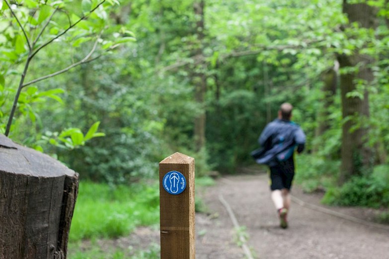
While we might have called them Run Routes, you don't have to run them - how you complete them is up to you, whether you run, jog, sprint or even stroll – it’s all about finding your own pace, getting outside and enjoying the many scenic spaces our city has to offer.
The routes are colour-coded so that, whatever your pace, you can choose trails that suit you from; Easy, Medium, Hard and Challenging.
While we might have called them Run Routes, you don't have to run them - how you complete them is up to you, whether you run, jog, sprint or even stroll – it’s all about finding your own pace, getting outside and enjoying the many scenic spaces our city has to offer.


Explore the Run Route locations across Sheffield:
- Bradfield to Damflask (5km / 10km) PDF map guide
- Central Sheffield (2.4km / 5.7km) PDF map guide
- Concord & Wooley Wood (2.5km / 4km) PDF map guide
- Ecclesall Wood (2km / 4km / 5km) PDF map guide
- Challenging routes to Stanage and back (14km / 24km) PDF map guide
- Firth Park (1.7km / 4.3km) PDF map guide
- Graves Park (2.5km / 4km) PDF map guide
- High Hazels & 70 Acre Hill (1.6km / 4.7km) PDF map guide
- The Ponderosa & Crookes Valley Park (1km / 3km) PDF map guide
- Rivelin Valley (2.1km / 3.7km) PDF map guide
- Shire Brook (1.3km / 5.3km) PDF map guide
- Thorncliffe (2.3km / 4km) PDF map guide
- Wharncliffe, Greno & Wheata Woods (1.2km / 4.5km / 10km) PDF map guide
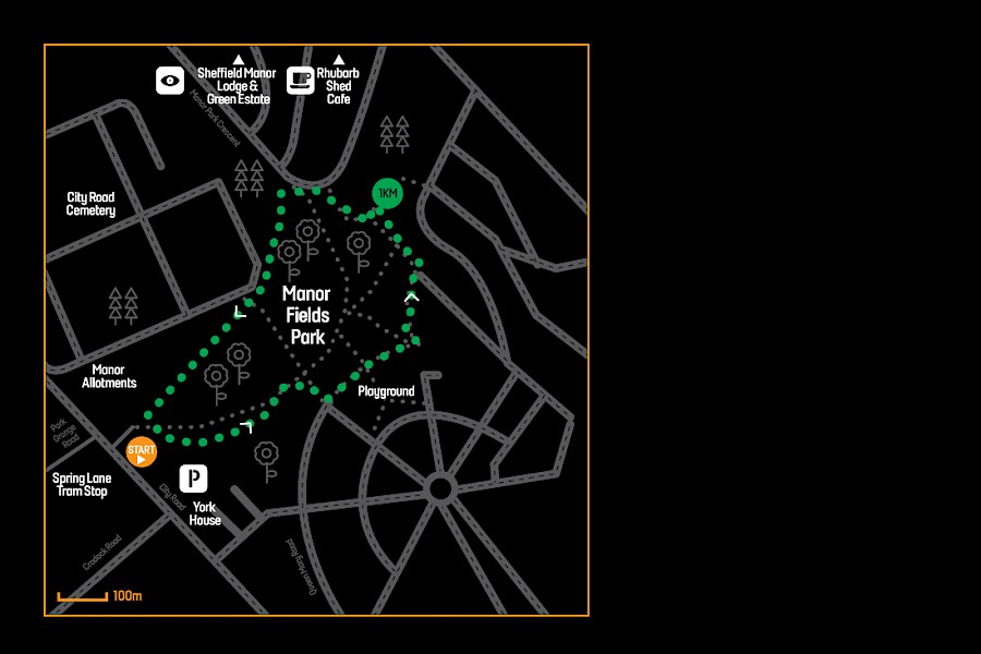
- Manor Fields Park (1.6km) JPEG Map
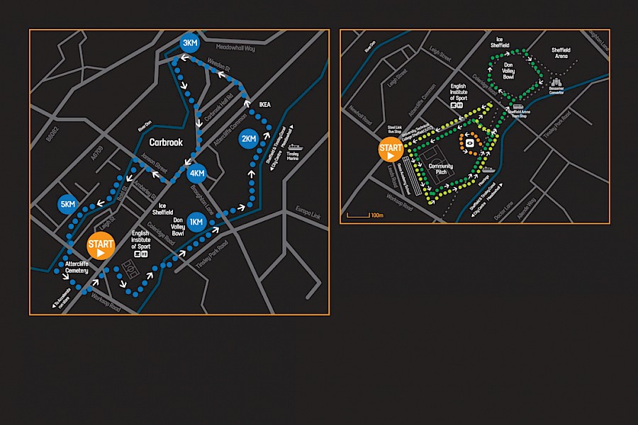
- Olympic Legacy Park and Don Valley (1km / 1.8km / 6km) JPEG Map
- Lowfield (355m) JPEG Map